38 Dead as 7.7 Earthquake Topples Buildings in Indonesia
A magnitude 7.7 earthquake off Indonesia's coast killed at least 38 people and injured dozens, triggering landslides and evacuations of 2,000 residents in the Flores region.

The powerful tremor hit at 5:58 a.m. local time at a shallow depth of just 6 miles, with its epicenter located 42 miles north-northwest of Ende city in East Nusa Tenggara province, the US Geological Survey confirmed. More than a dozen residents sustained injuries in the disaster.
Suharyanto, head of the National Disaster Management Agency, reported that rescue teams have recovered 38 bodies, with the highest death tolls concentrated in three severely affected regencies: Sikka, Manggarai and East Manggarai. A landslide in the village of Reok in Manggarai alone accounted for 16 fatalities.
At least 13 injured victims were transported to area hospitals, two of whom sustained serious injuries. The initial quake triggered multiple aftershocks that continued to rattle the region.
Mass Evacuations and Infrastructure Collapse
Approximately 2,000 villagers in Nagekeo regency abandoned their homes for temporary shelters as buildings crumbled and infrastructure failed across the island province. The disaster management agency deployed three helicopters and a rescue vessel to support emergency operations in the geographically challenging region, which comprises numerous islands that complicate access and transportation.
East Nusa Tenggara Police Chief Rudi Darmoko confirmed severe structural damage and building collapses throughout affected areas. Power outages across cities and villages have significantly hampered information flow and rescue efforts, he said, adding that earthquake-triggered landslides in Ende regency severed the Trans-Flores highway, a critical 435-mile paved mountain road connecting Labuan Bajo to Larantuka.
Panic and Destruction Across Multiple Regions
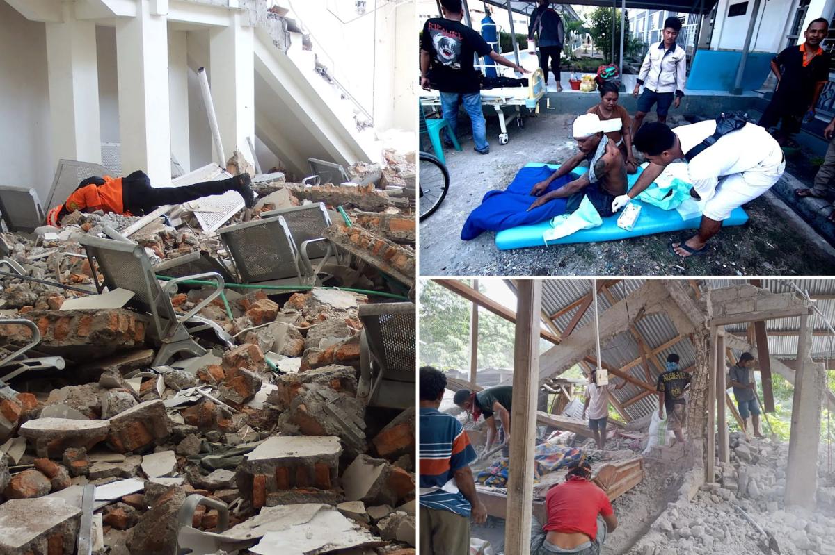
Yohanna Embu, a resident of Sikka regency, witnessed extensive building damage and crowds fleeing to higher ground. The waiting room at the port terminal in Maumere collapsed entirely, she reported.
At St. Peter Major Seminary in Sikka, students attending morning Mass fled in terror when an assembly hall roof caved in. Reverend Guidelbertus Tanga, rector of the seminary known locally as Ritapiret Seminary on the predominantly Catholic island, described chaotic scenes. At least one priest suffered a broken leg after jumping from a second-floor building during the tremor.
The earthquake also sparked panic in Labuan Bajo, the gateway town to Komodo National Park, one of Indonesia’s premier tourist destinations. Damage reports came in from Bima in neighboring West Nusa Tenggara province and parts of southern Sulawesi island.
Tsunami Warning Issued and Lifted
Indonesian authorities immediately issued a tsunami warning for parts of East Nusa Tenggara, West Nusa Tenggara, South Sulawesi and Southeast Sulawesi provinces, ordering residents away from beaches and riverbanks. The warning was later lifted after Indonesia’s Meteorology, Climatology and Geophysics Agency confirmed monitoring showed no significant sea-level changes threatening coastal communities.
Local television footage showed hospital patients being evacuated as a precautionary measure. Medical staff relocated equipment including beds, IV stands and oxygen cylinders outdoors, establishing temporary treatment areas to handle emergency conditions.
Ring of Fire Vulnerability
Indonesia, a sprawling archipelago of more than 17,000 islands, faces constant seismic and volcanic threats due to its position on the “Ring of Fire,” an arc of volcanoes and fault lines encircling the Pacific Basin. A powerful earthquake triggered a tsunami in 1992 that killed approximately 2,500 people on Flores island.
With information from New York Post